|
|
Tour 2002: SWEDENAround Stockholm. Km.: 1200... -days: 13- Month: JulyNEW! Click to see a MAP Click on thumbnails to zoom There are more pics in the Photo Album I don’t know why there aren’t more cyclists who chose Sweden as a destination. It has quite a lot of things to recommend it: its terrain is a good compromise between mountainous, rugged Norway and flat Finnland. Practically everywhere in Sweden, you are never far away from some real wilderness, and even in the (relatively) more urbanized South, it’s not difficult to ride bouts of twenty, thirty km. at a time whitout meeting any significant trace of human habitation, aside from the obligatory log cabin on the shore of practically every one of its innumerable lakes. Agricultural areas are often not much more than clearings in the forest, just like it was all over Europe centuries ago. On the other hand, at least in the South, the frequency with which one encounters urban agglomerations big enough to have at least a petrol station and a mini-market is still reassuring enough. Even more comforting, is the frequency with which the incredibly hospitable Youth Hostels are to be found (in all Scandinavian languages they are called litteraly Wanderers’ Homes, and you can hardly find a more welcoming-sounding term for cycling tourists, who may no longer be so young, but whose credentials as wanderers are undisputable).
As for inconvenients, there are really few, and one of the …biggest is undoubtedly its size… owing to which you’ll need more than your average two-week holiday to tour all of it. Another inconvenient, related to the former but maybe more easily overcome, is that you can’t carry your bike on Swedish trains, at least not without something like a couple of days’ previous notice. This is why I was practically forced to start and end my tour in Stockholm. There were other inconvenients I had but which aren’t necessarily related to every trip to Sweden. One was that I couldn’t find a way to take my bike with me this time, so I was forced to rent. And I would have thought that renting a decent touring bike in Stockholm, one of the most advanced cities in Europe, would have been less of a problem. In the end, I ended up with an excellent bike, but that was only thank to Peter , and finding him wasn’t exactly easy...
Day 1. Stockholm- Nynäshamn: 80 km. MAP
For someone, like me, who had never been to Stockholm before, it was really hard having to leave it without really seeing anything. But that was planned ahead, Stockholm was supposed to be the prize at the end of the trip. What I hadn’t foreseen was that it would be so hard simply to find my way out of it… Even with the help of the ultra-detailed cycling map of Stockholm City on sale at the main Tourist Office (invaluable because, even if it doesn’t make the task exactly easy, at least it makes it possible…). Expecially because the map ends in any case a lot sooner than the sprawling suburbs of Stockholm. In the end I decide simply to take the main road to Nynäshamn, not a bad idea, it turns out, because as soon as the countryside begins it becomes the only road anyway.
Day 2. Nynäshamn – Gotland (by ferry). Visby – Klintehamn: 30 km. MAP
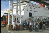
The following day, I cycle a couple of miles under a chilly drizzle to get to the terminal of the ferries that link the mainland with the island of Gotland. The boat I’ve booked is a sleek futuristic machine looking half carribean cruise ship, and half stealth destroyer. The 100 plus nautical miles passage to Visby takes a bit over three hours. Gotland is a very popular destination for Stockholm week-enders, cyclists in particular. And today we are only one day away from the start of one of the busiest week-end of summer (an arrangement I was unable to change after I became aware of the fact). Apparently, one of the reasons that make Gotland so popular is its climate. They say in Sweden that when it rains in Stockholm the sun shines in Gotland. In fact, when we land there, it’s at least dry and warm, although still overcast. Visby is the only town of some size in the whole island, and it’s also undoubtedly its jewel, a remarkably well preserved Hanseatic town still enclosed by a ring of medieval turreted walls. Being situated in neutral Sweden, it wasn’t bombed to rubble like its counterparts in German and Poland were. Gotlands retains also an amazing ninety-six XIV-century gotic churches, scattered all over the island, practically at every crossroad and also in between them (predictably, the crossroads soon ran out…): such was the surplus of wealth accumulated when Gotland was the main commerce hub in the Baltic sea. Leaving Visby on the southward-bound coastal road, the only built areas are very small hamlets like Klintehamn, where the largest concentration of building is the complex that functions as Inn-Hostel-Camping.
Day 3. Klintehamn – Burgsviken –Etelhem: 100 km. MAP
Gotland is not so small after all, and touring its huge network of cycling paths takes a lot longer than a week-end. I manage to cover less than half , sticking more often than not to driving roads (which in fact enable almost always to shortcut the tortuous cycling paths, and in any case are never very busy…). But a couple of detours cannot be avoided, because the scenery along the cycling paths is more interesting, and moreover it’s often the only way to get a glimpse of the sea. In fact, turning right just south of Klintehamn allows more than just that, as the path follows mainly the shore, with the coastal pine forest on one side, and a narrow beach on the other. I cannot help to think of our Adriatic coast:… before cement and high-rises, it mustn’t have looked much different, apart from the variety of pines. Offshore I can see the islands of Stora Karlsö and Lilla Karlsö, (if you've trouble remembering the names, try Big Charlie and Little Charlie, it worked for me..) When the path turns inland, it follows a series of long straights linked by sharp 90 degrees turns, which very soon throw my inward compass completely out of whack. In addition, this wandering starts to weight heavily on my odometer. It’s about time to find the driving road again and head to my final destination. Before that, however, I manage to get in sight of Burgsviken bay, which I hope is far enough to the south to count as land’s end… It’ll have to do, in any case, because after turning around I’ll still have quite a bit of road to cycle, through the villages of Hemse, Stånga, Lye, and finally Ethelem.
Day 4. Etelhem - Närsholmen -Ljugarn -Etelhem: 90 km.
I spend the next couple of days in a farm just outside the hamlet of Etelhem, because, this being, as I said before, one of the busiest week-ends of the year, I thought spending just one night might have been a bit rude … Besides, the room is about the same price as the hostel, or rather, it would have been, had I been able to share it. Understandably, here I cannot ask to pay just for the bed, (by the way, in the hostels, every time that it was at all possible, they never asked me to share!). The downside, if it can be regarded this way, is that on this one day between nights I’ll have to cycle a loop. I try to include at least Ljugarn in it, of course, so as to be able to say I have cycled Gotland coast to coast, even if along the shortest axis (east-west). Pushing further to the north doesn’t look like a problem, until I find myself busy chasing gotic Churches around Garda, Lye, Burs, När... where there is an unusual concentration of them (unusual anywhere outside Gotland, that is..). It’ s amazing how they may look so similar at first sight and yet each turns out to have its peculiarities, and who would have ever though that… one could get so absorbed in considerations of this sort so as not to notice that he is riding on an icreasingly empty stomach, and it’s getting late and there doesn’t seem to be any place around when one can get anything to eat... By the time I reach the Baltic shore near the solitary Närsholmen lighhouse, I am already resigned to staying hungry until Ljugarn, when in the middle of nowhere I find myself standing in front of the gate of a golf course which has, naturally, a well-supplied cafeteria (as a rule of thumb, you can turn golf portions into cycling portions by roughly doubling them…) Even if I cannot say how Ljugarn would have looked from a starving cyclist point of view, I believe I can still give an unbiased, and totaly appreciative, judgement. Ljugarn is one of just a couple of village-sized settlements outside Visby, and its wooden vacationing cottages, the open-air pizzerias and ice-cream kiosks give it the mellow apperance of a ’50ies to ’60ies seaside resort.
Day 5. Etelhem –Visby: 60 km. Gotland-Oskarshamn (by ferry) MAP
The ride to Visby through Gotland’s countryside is particularly pleasant in this warm, sunny sunday morning, althought there’s really nothing of note to see along the way, with the considerable exception of the Romakloster ruins (which appear to have been turned into an open-air theatre for the summer season). But a mid-summer sunday in Visby is simply something not to be missed, being the time when the Swedish really let their (straw-blond) hair down. Being Swedish, of course, they don’t seem to be doing much beside that, certainly nothing loud or outlandish… but cleary some prefer it that way (including me). The animation winds down anyway as the time of departure of the mainland ferries approaches. The last places on the boats have been booked for weeks now (I’ve booked mine a couple of months ago…) I board a bigger but slower ship for the four-hour long passage to Oskarshamn, a port town on the Småland coast, from where I plan to begin my long overland trip back to Stockholm.
Day 6-7. Oskarshamn – Gränna (lake Vättern) : 200 km. MAP1 ; MAP2
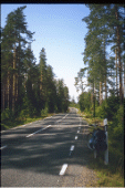
From Oskarshamn the woods are only a few km. inland, and for the next two days, until I get to the shores of lake Vättern, they’ll remain the main feature of the landscape. Småland is in fact one of the most forested regions in the south of Sweden. Stretches of 20 km. or so between walls of conifers on either side of the road are not uncommon. Farmed bits are mostly clearings, often situated at the bottom of valleys alongside the road. These are generally the flattest bits. As the day advances, they become also the hottest, as summer seems to have settled in for good. Luckily the long forest stretches provide a welcome shade. Unlike Gotland, mainland Sweden is rarely flat. The terrain in Småland is mostly low hills and ridges whose ondulations the road embraces in a never-ending rollercoast. Road traffic is scant, even if here there are really no secondary roads, except those that take you nowhere… but even on the main arteries, the towns of any size between the coast and Vättern are few and far between. The one where I stop for the night, Bruzaholm doesn’t look much more than a service station… They are not without interest, though. One of the most remarkable is Eksjö, were the town centre has a number of well preserved old buildings from the last couple of centuries. Sweden being mostly rural, and wood the most frequently used building material there, many small-sized town and villages look modern, with little or no remains from their nevertheless often storied past. The region becomes hillier as one approaches lake Vättern, with a couple of real climbs before the final steep, switchbacked plunge carved in the crags that overlook the lake. A more gently sloping apron of land extends from the foothills to the lake shores. It is intensely cultivated, and it accomodates the roads circling the lake and its main settlements, like Gränna, tucked between the craggy foothils and the lake shore. Along its main road, cafes and confectionery shops sell Granna’s typical product, the Polkagris, striped rock candy, a confection that in a sense suits the character of this family-oriented lakeside resort.
Day 8. Gränna –Vadstena: 60 km. MAP
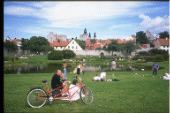
The sun rises early at these latitudes, and by 8-9 o’clock the temperature starts to climb rapidly. The road follows the narrow, intensely cultivated coastal plain, where there’s very little shade. By the time I reach Ödeshög, both my water-bottles are empty, so I stop to fill up on minerals-replacing beverages, and change into a sleeveless top that I brought along mainly because, as an additional layer of clothing, takes up very little space and weights almost nothing. Leaving Ödeshög to the north the road turns away from the east shore of Vättern to skirt another, “lesser” lake, the Tåkern. I turn left on a secondary road that climbs the Omberg heights, a forested promontory overlooking Vättern. The climb is steep but mercifully shaded. The dense forest opens only here and there on my left to afford magnificent views over the lake. After exiting the forest, the shortest way to get to Vadstena is to regain the main road. The temperatures on the treeless plain, swept by an annoyingly hot wind, are well above 30° C. In the early afternoon heat the ondulating countriside seems to liquify, and on the mirage-like waves float the brightly coloured buildings of scandinavian farms. The fame of Vadstena derives mainly from its religious history, and to these days it’s a kind of Swedish Assisi. From opposite points on the shores of lake Vättern, two buildings dominate the town, the Castle, and the Abbey of St.Birgitta. But on this particular day the austerity that they may otherwise impart to the lakeside area is completely lost, every available space being occupied by sunbathers. Also, in the summer the moat of the Castle, whose waters flow in from the lake, doubles as a yachting harbour.
Day 9. Vadstena – Norrköping: 130 km. MAP
Night thunderstorms lessen the heat of the previous day. The sky is still cloudy in the morning, but the rain has stopped for the day. There’s still wind, but it's mostly pushing. This is not as much help as it sounds, as the road continues to be hilly, and the longest flat bit, the one that follows the Göta Canal, is sheltered by the banks of the Canal itself. This stretch alone is 40 + km. on a mostly unpaved towpath, and is preceded by a long ride on the rolling Östergotland countryside, untile the Borensberg locks. Then, after the imposing Bergs locks, a 30 km. half-circle around lake Roxen follows (the northern half has less traffic, and better views over the lake). By the time one reaches Norsholm locks, Norrköping is almost (but not yet…) there. And still farther (another 5 km. after the 20 to Norrköping), is my final destination, Lindö, a villages on the shores of the Bråviken (a sea inlet that links to the Baltic sea: when I’ll be arrived, I’ll have effectively crossed from lake Vättern to the sea in one day-long stage…). As I won’t be spending the night in Norrköping, I try to get some time to visit the town before riding on to Lindö. It’s time well spent: and not only because Norrköping is the first real city since I left Stockholm. One of the most interesting attractions of this city is, oddly enough, a legacy of its industrial past: a complex of XIX century textile factories that has been the object of a particularly succesful restoration, and today hosts part of the city university and most of its museums. As far as cities go, it may well be that I am prejudices against their hostels, but as much (or rather, as little…) as I can say about the hostels in Norrköping, the choice of Lindö turns out to be a happy one indeed. The hostel is situated in an old estate on a wooded slope overlooking the Bråviken. The restaurant and the reception are housed in brightly lit, yellow coloured wooden cotatges, and hosts sleep in log cabins in the wood, a charming environment in which I enjoy a thoroughly pleasant and relaxing stay.
Day 10. Norrköping – Bjorlunda: 130 km. MAP
The ride today won’t exactly be a short one, in fact, it will be exactly as long as that of the day before… It will also be a rather …landlocked one, as, after I leave the Bråviken, which happens very soon, that will also be the last I’ll have seen of the sea for a while (as I’ll explain later, even when I get near it again today, I won’t be able to see it…). Even lakes are unexpectedly few. In short, this one will be mostly a ride in the countryside … In fact, there's also only one town of any size: Nyköping. But this is Sweden, when lakes outnumber towns, and you can ride more than a hundred km. without seeing much of either kind… Woods themselves seem to keep at a distance, although they are often tantalizingly close. But on both sides of the long road that runs the lenght of the Kilaån valley (mostly straight, though by no means flat…), the land is mostly cultivated, and tall aluminum-sided silos reflect the dazzling sunlight, lighthouse-like, for kilometers around. Nyköping is situated on a deep and narrow inlet branching inland, once again, from the Baltic sea. So deep and narrow, in fact, as to be practically indistinguishable from a lake (a small one at that…) or even a canal... Still, the harbour is one of Nyköping most picturesque areas . This quasi-maritime experience soon fades as the land retakes its iron grip over the landscape (so to say, I imagine this involves other minerals as well…). There are still 40 km. to reach Bjornlunda, through the woods and countryside of Södermanland. Even if I’m cycling on one of the main roads in the area, there’s practically no traffic to speak of.Bjornluda itself is a major crossroad, and yet, aside from one single street of recently built cottages, it’s just a name on the map. The fact is that, even if road signs indicate that Stockholm is less than hundred km. away, this place might well be its antipodies. In Bjornlunda, in any case, another of those fairy tale hostels awaits me. This time is in a farm, beautifully restored to its XVIII century (at least, I think) appearance. Surely older are the enormous oak-trees that shadow its green courtyard. To reach my room I have to climb a narrow and steep stair, then bow to enter the metre tall doorway. The whole setup has a bit of a Chicken Run feeling, but the room is spacious and cozy, and, once again, I have it all for me (of course, I would have been only too happy to share it with the occasional chick…).
Day 11. Bjornlunda – Enköping: 100 km. MAP
Today there’s more water to be seen than the day before, beginning with a small lake a few kilometers outside Bjornlunda, where a family of Swedish holidayers is busy diving from a floating platform. But, in the end, all the shores, beaches, lakeside promenades and yachting harbours I’m going to see today belong to just the one, huge, labyrinthine lake which is the same where the Roda Båten, the floating hostel where I spent my first night in Stockhom, was moored: the Mälaren. And, on lake Mälaren, few places are as picturesque, albeit unapologetically touristy, than Mariefred. Here the view over the lake opens on a wide expanse of water, and it's actually possible to get a visual impression of the lake branching in different directions, east toward Stockholm, and west further inland, taking up over a fourth of the entire width of mainland Sweden at this point. The shores all around Mariefred are covered by thick forest. Here and there, its opens to reveal the stately facade of a country villa reflecting itself on the waters. An even more imposting building is Gripsholm Slott, whose salmon-pink turrets rise just opposite from the village of Mariefred, towering over the masts of the sailing yachts at anchor in the Marina.
Mariefred comes complete with steamboats ferrying tourists between the lake main resorts, and even a steam-powered railway whose other terminal is situated a few km. inland just off the Stockholm-bound motorway. Leaving Mariefred and cycling in the opposite direction, one is never far away from Mälaren, yet comes rarely within sight of it, as its shores stretch meanderingly in every direction, until Strängnäs. Strängnäs is just a bit less touristy than Mariefred, but, it seems, more seriously developed as a lakeside resort, with a special emphasis on boating and sailing. And it’s not short on cultural attractions either, its cathedral being one of the most noteworthy examples of medieval architecture in the entire country. From there on to Enköping there’s decidedly more water to be seen, as the road cuts directly across the lake, following a succession of islands and bridges. Given the vastness of lake Mälaren, this road is the only one linking the south and the nord of the country in an area more than 100 km. wide. So on this day, marking the beginning of the busiest week-end of the summer, it attracts quite a lot of road traffic. My final destination lays, once again, a few kilometers beyond Enköping, and still on the shores of lake Mälaren. Beside the hostel, there aren’t many buildings to be found in Bredsand, but it's nonetheless a very crowded location, thanks to a huge camping ground discreetly located in the woods that surround a placid crescent-shaped beach.
Day 12. Enköping– Uppsala: 60km. MAP
The end of my trip is approaching, in fact the last couple of days I have been orbiting around Stockholm, which was never more than one (long) cycling day away. But this tour would’t really be complete if it failed to include Uppsala, an ideal “summit”, not only culturally but also geographically. In Sweden, Uppsala is said to mark the boundary between the South, urban and civilized, and the North, vast and wild. For centuries, this has been one of the northernmost points reached by European civilization, the frontier beyond which agriculture, roads and large urban settlements could be extended only sparingly and with difficulty. As a last outpost, Uppsala was certainly not the least: to Sweden it’s a bit like Oxford and Canterbury put together, hosting both its most storied and prestigious university, and its most holy ecclesiastical See. The gothic cathedral, one of the largest ever built, still dominates the town and the coutryside for kilometres around (to be perfectly honest, there’s doesn’t seem to be much else of note on the road between Enköping and Uppsala: the wild North may be just around the corner, but turning a corner around here may easily take another day of cycling… Still, I was really thrilled when I spotted a couple of those elk-warning road signs…) In any case, there could hardly have been a better way to see Uppsala on this midsummer Sunday than on a bycicle (except, maybe, line-skating: a couple of blocks in the city centre had been turned into a race track…). The city was deserted and road traffic totally non-existent, so I could tour it at leisure, in fact I did it several times, as Uppsala is not such a big town after all… I even got the time to visit Linneus’ famed botanical gardens (the assortment of specimens was surely impressive, but quite a few looked a bit wilted and dusty, evidently having trouble to acclimatize to this unusually tropical scandinavian summer).
Day 13. Uppsala – Stockholm: 90 km. MAP
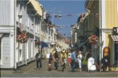
Even if it skirts one of the busiest spots in the country's transportation network (bundling together in a few kilometers one of its main motorways, railway lines, as well as Stockholm international airport, Arlanda…), this itinerary represents (at least in the first half) a pleasant surprise. Most of it follows a (relatively) well signed cycling route (rather than path, as most of it is not closed to motorized traffic), the Upplandsleden, and it includes Sigtuna, considered one of Sweden’s oldest cities. My visit took very little time, I admit, as I was worried (with reason, as it turned out) about the approach to Stockholm. But from what I saw, Old Sigtuna turned out to be basicaly an agglomerate of romanic, some pre-romanic, churches, mostly in ruin, and, as expected, all of them stone buildings. Sigtuna one main street didn’t look much different from what I’d seen in Eksjö or Vadstena, while the crowds of tourists reminded me of Mariefred. Likewise, most of the charm of Sigtuna comes ultimately from its location, and its shores are again washed (after a particularly convoluted path) by the waters of lake Mälaren.
As for the approach to Stockholm, everything goes well until past Arlanda. Then one enters the northernmost suburbs of Stockholm and, as it happened to find the southbound exit, things start to get ugly… Cycling signs become less frequent, confusing, then disappear alltogether… Stockholm suburbs are laid out like maze-like galaxies whose streets orbit endlessy on themselves, giant black holes of modern urban planning that suck unwary cyclists to their centre where they presumably disappear forever (I, one of the lucky few to have escaped, managed to catch only a distant glimpse of those hellish cores and I swear that what I saw were stairs!… everywhere! for heaven’s sake, even streets had disappeared, a pure cyclists’ hell, I tell you again… ) The only mean powerful enough (risky too…) to pull me away in the opposite direction, was a five-lane motorway… at the end of this Odyssey I found myself somewhere tantalizingly close (but still obviously ouside) the northern boundary of my Stockholm City cycling map. At that point what I needed was some sort of divine intervention, and it punctually occurred… and I must confess my first thought was that the ways of heavenly camouflage were not what they used to be. A bicycle and a pair of glasses were clearly not enough to disguise the heavenly nature of that creature… but sorry , don’t ask, … here I won’t tell you more than the cycling side of the story… which was that I managed to check in at the hostel and return the bicycle to Peter on time (who, if sent in its turn from somewhere above, was surely better disguised, à la Wim Wenders…).
Take the time to browse the photo album for more pictures (you've already read this far anyway...)
[Home Page]-|-[
France]-|-[
Ireland]-|-[
Italy]-|-[
Germany]- |-[
Scotland]-|-[
Norway]-|-[
United States]
|


