|
|
|||||||||||||||||
|
Tour 2001: NORWAY- Lofoten Islands
Cycling above the Arctic Circle…
Km.: 480 -days: 6- Month: Luglio (Since I tend to use only ASCII characters in my texts, Norwegian names have been written without the å e ø wovels that would appear in the correct Norwegian spelling) NEW! Click to see a MAP and where's Lofoten
Click on thumbnails to zoom;
there are more pictures in
the photo
album. Click below. The Lofoten Islands
are one of the most accessible... remote spots on earth. Just a bit more
than a couple of hours away from Oslo by plane (there are three airports in
the islands, although the great majority of travelers come from the mainland
by ferry). The Lofoten have been inhabited permanently since prehistoric
times, and at all epochs have enjoyed a level of civilization comparatively
high. Agriculture is practiced all year round, one of the very few places on
the planet where this is possible at so high a Latitude. All this thanks to
the Gulf Stream, that gives to these islands a climate day by day more
enjoyable than regions situated more than 1000 km. to the south, like the Fjordland, or Scotland, for example. Still, the Lofotens lie to the north of
Iceland, a part of Greenland, and much of Siberia and Alaska! In the
summertime, the sun rises at the beginning of June... and never sets again
until the first half of July. So, cycling in these islands retains all the
feelings of an adventure... and practically none of the disadvantages!
In Bodo, getting on to Lofoten My Lofoten bound voyage begins when the airplane,
after descending through several layers of overcast, lands (flying blind, as the runway becomes
visible only in the very last seconds) in Bodo airport. After
claiming my luggage, I assemble the bicycle, then try to find a place where I
can leave the cumbersome case that contained it (to carry it safely through a
couple of plane changes), and obviously doesn’t fit in the airports luggage
lockers. Fortunately inquiring at the Information desk I learn that there is
a semi-official storage room that I can use.
I leave the airport under a cloudy sky and a persistent drizzle. In
this grey, interminable arctic afternoon,
Bodo doesn’t look exactly appealing. Having already had three meals on
three different flights, I take refuge in the Youth Hostel, which is situated
in the same building as the train station.
The following day, around noon,
the train station, normaly the first building you notice in the harbour area,
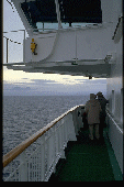
is dwarfed by the bulk of the M/S Richard With, the ship that will
take me to the Lofotens. The R. With is one of the Hurtigrute (i.e.,
not a ferry) boats, the so called
“Coastal Steamers” sailing daily from Bergen for an 11 day cruise up
to Kirkenes, on the Russian border (actually the word Hurtigrute means
something like “fast route”, which indeed it was, before planes came around).
Today Hurtigrute boats are
regular cruise ships, over 100 mt. in
lenght and 10000 t gross tonnage. And a luxury cruise too, even if a
simple passage to the next port of call is perfectly affordable. In its
northbound trip from Bodo, the Hurtigrute calls twice in the Lofotens,
the first time in Stamsund, at 7 p.m., and the second in Svolvaer at 4 p.m. (full day in this
time of year, but still a bit inconvenient, so I decide to get off in
Stamsund ).
Day one: Stamsund-Henningsvaer-Stamsund.
Km. 120
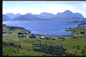
Seen from the ship for the first time, the
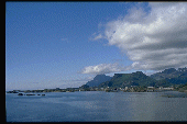
Lofoten appear like an uninterrupted series of jagged, teeth-like peaks, the Lofotenveggen
(Lofoten Wall). The five main islands of the archipelago are in fact
separated by sea channels so narrow that all of them are today crossed by
bridges, and, in one case, by an underwater tunnel. Some of these channels
become visible only a few hundred metres before coming on the bridge,
so there’s no way to spot them from the bridge of a ship several miles offshore. Getting off in Stamsund, which
is located more or less midway along the road crossing the island from north
to south, means that my itinerary will follow a bit of a back-and-forth
route. This is no problem, because the distance from one tip of the islands to
the other is only about 280 km. Also, passing through one place more
than once will increase the chances of seeing
it on a good weather day (it will
work, in fact). In Stamsund I stay at the Youth Hostel, which is housed in a series
of rorbu cabins (of which, more later). The main difference with rorbuer
which are not hostels is that the latter normally won’t allow you to share a
cabin. It rains during the night(-time) and in the morning the sky is still
completely overcast. Although dark storm clouds are visible beyond the
mountains to the west, only very little rain falls on the coast when I am
cycling. I soon realize that the Lofoten are a textbook case of islands with
a weather side (NNW), and a lee side (SSE). Lofoten’s main towns and most
villages are to be found on the
latter. I had meant to do a complete loop around Vestvagoy, but I
think better of it and decide to remain on the lee side of the island for the
time being. I follow the road that skirts the Vestfjorden, the
“inner sea” between the islands and mainland Norway. It winds along a series
of inlets and headlands surmounted on the land side by towering peaks. Frome
here to the Gimsoystraumen, the Y shaped channel that separates
the islands of Vestvagoy from Gimsoy and Austvagoy, there are only half a dozen small
hamlets huddled around a petrol station and/or a minimarket. When I reach
the first of the two bridges that cross the Gimsoystraumen, I notice that
this is one of the few places where the Lofotenveggen lowers its guard and the lets the god-awful
weather coming from the west pass
through to the sheltered side of the islands.
So I decide to give up any further attempt to
find a North-West Passage, including a shorter loop around Gimsoy (only
postponed though...) and decide to head toward Henningsvaer, a fishing
village already visible across the strait at the foot of the impressive walls
of Vagakallen. In this way I can avoid the detour tomorrow, when I
will pass by this same road. The Gimsoytraumen
crossing takes place under a cold rain and sudden gusts of wind that force me
to shift my weight slightly to the left to keep my balance. This balancing
act is complicated by the fact that I am now riding on the E10, the backbone
of Lofoten road network, and passing
motor homes, coaches and lorries create a treacherous alternating of wind and
calm … Most of all, I am worried about crossing the Gimsoystraumbrua,
the second of the two bridges, longer, higher and most exposed. But it proves
easier than what it looked. To
get to Henningsvaer I turn right from the E10 on a road full of short but
rather steep and ultimately tiresome
humps. I’m glad I have to go through it only this time (though in both
directions). Henningsvaer is described in some guides as “the Venice of the
Lofoten”. Granted, it has a canal... and, square foot by square foot, its
share of tourists. But Lofotens other fishing villages, Stamsund to begin
with, are all equally pretty. I stop in a Cafe’ for a plate of bacalao
(our baccala’ as well as Portugal’s bacalhau), not a Norwegian
recipe, as far as I know , although the Lofoten supply the main ingredient
for it: stockfish..
Day Two:
Stamsund-Hov-Kabelvag. Km. 100
|
|
|
Back on the E10, and this time ignoring the
Henningsvaer detour, I start to climb toward a seemingly impregnable barrier
of mountains. The climb is shorter that expected, though, because after one
km. or so the road enters a tunnel (in anticipation of which I had
equipped my bike with rear and front
light). Emerging from the tunnel the road takes a steep plunge to the bottom
of a deserted valley surrounded by steep and rugged mountains. Where,
suddenly, the sun emerges from under the clouds, and the temperature starts
to rise. I have to remove several layers of clothing even before reaching Kabelvag (which is in fact litterally around the
corner). As suddenly as the apparition of the sun, I emerge from the
wilderness into Lofoten’s main urban area... composed of Kabelvag, Svolvaer, and a series of smaller hamlets. Just before Kabelvag there’s even a
cycling path flanking the E10, paved and of confortable width, although there
are no signs to indicate where it begins. Kabelvag is a delightful village
clustered around the harbour, and in this cloudless, still evening, an ideal
place to spend an arctic midnight (although you can’t see the midnight sun
from here, as the sun sets behind the mountains to the north, you can enjoy an
equally impressive spectacle: that of the norwegian coast, distant more than
150 km. illuminated by the soft, rosy light of the midnight sun).
|
|
Day three:
Kabelvag-Laukvik-Kabelvag. Km. 90
MAP
The following days begins (actually it never
ended...) warm and sunny. At 9 in the morning the temperature is already
above 20° C (the sun has been heating the atmosphere for at least seven hours
by now). I start off wearing cycling shorts that I’ll keep
on until the end of
the trip (when cycling, that is, and I have more than one pair...) After only
five kilometers I reach Svolvaer, Lofoten’s largest urban
agglomeration (about 5000 inhabitants...) Svolvaer is the main port of call
for ships reaching Lofoten from the mainland, and Lofoten’s main Tourist
Information Office has its premises beside the pier. But the town’s best
attraction are probably, in fact, its people. Svolvaer looks and feels so
much like any other Northern European small town that when you walk its
streets you lose any sense of how remote and isolated it actually is. But you
only have to cycle a kilometer or so further up the northbound road to be
immersed again in almost completely unspoilt wilderness. As soon as I exit
the short tunnel that overlooks the Hellesnet cape, I find myself at
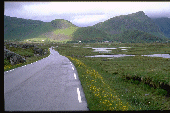
the centre of an awesome landscape of green meadows, turquoise glacial lakes
and narrow fjords bordered by rugged, vertiginous peaks. In fact, Hellesnet
peninsula hosts Svolvaer airport, but the only sign of its presence are a
couple of road signs and the taxis that zoom by. The traffic thins as I push
further on along the shores of the Austnesfjorden, a deep liquid gash
that penetrates far into Ausvagoy’s rugged interior. Only a few fisherman
cabins dot the shore along this side of the fjord, and none whatsoever on the
opposide side, where a wall of sharp granite towers plunges straight into the
sea. The part of Austvagoy opposite the fjord is a completely uninhabited
mountain wilderness that can only be explored through a number of hiking
paths and difficult mountain climbs. The fjords widens somehow, around Vestpollen,
where a narrow peninsula sticks deeply into the calm flatness of the
mountain-sheltered pool. The narrow tongue of land hosts a few cabins and a
small wooden church. Both branches of the Y-shaped intersection here would
take me to Fiskebol, on the shore facing the Artic sea. I take the one
to the left, through which I won’t get to Fiskebol (the road is not paved
until there), but I’ll cycle the only paved road that crosses Ausvagoy from
sea to sea. The road winds through an alpine looking valley climbing a pass that
is in fact not much more than a bump, then descending along a couple of
glacial lakes to reach the shores of Vatnfjorden (looking very much
like a lake in its turn, but perhaps communicating with the sea through the
marshy terrain at its northern extremity.
When I reach the seashore on the opposite side of the island I cycle a
couple of kilometers further to the south-west until I reach Laukvik,
a small hamlet of pretty wooden cottages that appear to be mainly
inhabited by tourists. From here to Svolvaer it’s 40 km., and coming here I
haven’t passed more than a couple of other hamlets even smaller than this
one, so I assume this place is remote enough. It will have to do, in any
case, as this is also the turnaround point of my tour. From here I will cycle
straight to the southernmost tip of Lofoten, a trip of about 240 km., in two
and a half days (the half day being, of course, today return ride to
Kabelvag).
|
|
Day four: Kabelvag-Ballstadt. Km. 90
MAP
Although I have already cycled three times
the better part of today’s itinerary, it’s not entirely deja-vu. For the first time, the sun shines along the whole
route, and under the cloudless blue sky the islands look disconcertingly
mediterranean: in the shallow coves and inlets the water is bottle-green and
the sand on the small beaches brilliant white. Today it’s Sunday, and I ride
all the way back to the Gimsoystraumen without practically seeing a car. Then
I leave the E10 and find even less traffic on the coastal road of Vestvagoy.
Norwegians wake up late today, to spend the afternoon on the beach or sunbathing
in their backyards, obliterating any residual arctic atmosphere. The term
arctic circle sounds not only abstract but downright antithetic to anything
that I am experiencing today. The coastal road looks like a mediterranean corniche. In the distance, the steeple
of Stamsund bellfry reflects the midday sun with the brilliance of a
lighthouse.
|
|
It no longer indicates the way for me,
though: this time I will take the opposite direction, first toward Leknes, then, after a km. or two,
toward Sennesvika. The view embraces
a narrow fjord and, on the opposite side, the
peak of Steinstinden, whose hidden face towers above Stamsund (and
the one facing the fjord
over the small fishing village of Steine). The backyards of Sennesvika brightly painted cottages
are animated by norwegians attired in totally unarctic fashion. I unzip
the neck of my
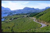
cycling jersey to begin the steepest climb of the tour, the 100 mt. high Einangen. From the top, there’s a
spectacular view that embraces the
better part of Lofoten’s east coast, with the by now familiar coves and
headlands of Vestvagoy and Austvagoy behind me, and, ahead of me , seen for
the first time, the peaks of Flakstadoy
and Moskenesoy, crowning the
cultivated coastal plains around
the Busknesfjorden, with the towns
of Leknes to my left and, Gravdal
to the right. I descend into the plain and cycle four kilometers against a
blustering head wind to Leknes, where, fortunately, I must do a U turn to
reach Gravdal from the opposite side of the fjord. A large wooden church painted bright red dominates the village.
From Gravdal to Ballstad, the wind
is still in my favour, but its benefit is somewhat lessened by the
ondulations of the road.
|
|
Day five: Ballstad-Reine-A Km. 70
MAP
In Ballstad I do my only rorbu camping in Lofoten. This is not strictly true, because a
couple of the hostels in which I stayed are also housed in rorbuer. But Ballstad’s Kraemmervika Rorbuer is not a hostel,
which means I have to rent a cabin all by myself and pay the price. It’s
worth doing it if only once, though, because this type of rorbuer are incredibly cozy, in fact
staying there has very little to do with camping at all… If shared with other
people, and rented on a weekly basis, as it’s meant to be, it would also have
been cheap for Norway, expecially considering that every cabin has its own
kitchen, and people who stay there do their own shopping and cooking and rarely visit the rather expensive restaurant (people who are not as good as
the resident chef will be tempted
eventually, and you have to be very good indeed to beat her or him…).
|
|
In any case, another reason to stay here is because
Kraemmervika operates a “cycling
boat” that links Ballstad with Nusfjord,
across the Nappstraumen on the
island of Flakstadoy, thus allowing to avoid the long submarine road tunnel
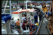
of Napp. The bicycle ferry is, rather predictably, a fishing boat. What was
less predictable is that this particular fishing boat –or rather its skipper,
on the request of a couple of norwegian passengers- decides to return to its
original vocation. A bit worried, I wonder how
long this fishing interlude is
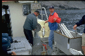
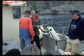
going to take, failing to take into account both the renowned abundance (even
off season)of Vestfjorden fish population, and the efficacity of modern fishing equipment: after five
minutes of sailing in circles with the sonar on, my fellow-cycling-passengers-turned-fishermen manage to haul in a cod big enough to
satisfy their fishing aspirations for the time being.
|
|
Still, its almost 3.00 p.m. by the time our
boat puts in at Nusfjord. My fears are not dispelled, because even if today’s
route is not very long, the time left to cycle it is also short, and I have
never cycled this road before. I still don’t know how right I am to worry…
For the moment, though, Nusfjord looks like a picture perfect fishing village
placed in an enchanting location, and even if the sky has become cloudy, the
temperature is the warmest I have experienced so far (owing to violent
downdrafts produced by 30 knots strong southwest winds, of which I am still
blissfully unaware…). I leave
Nusfjord through a narrow gorge shadowed by the forbidding (even more so
under the overcast sky) Stjerntinden.
Flakstadpollen looks more idyllic,
but here I meet the E10 again, and my troubles start in earnest. From here
on, there’s practically no road but the E10, and all the road traffic,
composed in almost equal proportion of cars, motor homes, touring buses and
lorries, is channeled here (and left, after that, very much to its own
devices…) The only upside is that the
road, for the moment, is rather wide (though full of blind turns…) and flat. Still, when I reach Flakstad and the nearby beach, one of
the widest in Lofoten, I turn sharply into the vast and almost empty parking
lot to get a break from the noise, the fumes and the tension. In spite of the
warm temperature, I resist the temptation to take a bath, mostly to avoid
wasting time. Considering what the road ahead
is like it turns out to be the
right decision.
|
|
As soon as the road turns a corner around the
cliffs that shelter the northern shore of Flakstadoy, and penetrates into the
deep cut of the Selfjorden, a
furious southerly wind invests me right in the front. The Selfjorden, along
with its southern omologue, the Skjelfjorden,
form a valley system that effectively
cuts through the Lofoten Wall from sea to sea. The narrow and flat tongue of
land separating these two deep water inlets is no barrier against the strong northerly
(as well as southerly) winds that ride
in front of, respectively, high and low pressure systems. In fact, in this
same point, soaring mountain walls on either side squeeze the wind through, sort
of like in a Venturi funnel, focusing
its blast directly on the road that skirts the bare shores of the fjord. A sysiphean effort is
required to cover the three kilometres between Ramberg and the Fredvang bridges. Shortly before this point the road
turns right on the aforementioned strip of land, broadside to the wind just
where it blows at its strongest. Proceding very cautiously, I manage to cover
these (fortunately) few hundred metres without being forced to put a foot
down. After that, the road becomes more sheltered, but only because it follows
a series of short but steep humps. In
short, the going doesn’t really get any easier. In fact, it’s only a matter
of (masochistic) taste to determine which was tougher, the wind or the humps.
And I haven’t even mentioned the fact that during the whole stretch the
traffic has only gotten worse … From there to A, where the road (and the suffering) ends, there won’t be any
real flat bit of road, and the gradients, at times, will get pretty steep. To resume, this last, shortest stage of the tour
will also be, and by
far, the hardest.
|
|
Day six: Reine-Hamnoy. Km. 7 (walking!)
Having already had enough of the busy, humpy,
and in the last bit also narrow and potholed E-10, I decide this last day to
simply walk between Reine and Hamnoy, the better to savour the
justly renowned views of the Kerkfjorden
and its World-heritage classed villages. Walking is in any case better than cycling when one has to stop
every hundred metres or so to take a picture. The day starts under a low overcast and a light drizzle, but the
weather improves by the time I step out of the express
coach. It turns into a sunny, balmy and breezy afternoon, ideal to appreciate
the majestic scenery of craggy peaks, deep blue waters and postcard pretty
fishing villages. Finally, allow me to say a few words about the village of A, where I spent my last couple of
days in Lofoten. A hosts the Stockfish Museum, where Italian people get a place
of honour as most avid consumers of Lofoten’s main export product. A also functions
as an accurately preserved example of Norway XIX century fishing village,
with some of the buildings that form the historic core of the village still permanently
inhabited today as part of the Youth Hostel, Rorbuer and Tearoom. A would be Lofoten’s southernmost point,
except that farther south there are still two small islands, Vaeroy and Rost. Vaeroy is visible from the point where the road ends, just
outside A, across a sea channel where strong currents give origin to what is
nothing less that the original Maelstrom celebrated by E.A. Poe (flat
as a mirror when I saw it…).
Don’t forget to browse the photo album for
more pictures.


