|
|
||||||||
|
IRELAND
1. Kerry and
Cork
Killarney-Kenmare-Bantry-Schull-Killarney.
Km.: 400 -days: 6- Month: July
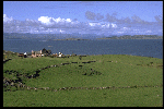
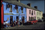
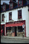
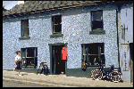
Click on thumbnails to zoom
The majority of those that are
going to read these pages in English, will, of course, already know Ireland a
lot better than I do. For the very few who don't, there are many sites in
English on the Web that contain all the information that one may want to get
about the Emerald Island and then some. This page is not a guide, but rather
a description of our itinerary. I am sure that all the names that will be
mentioned in the process will ring a lot of bells. We start our tour in Killarney,
from where we take the direction of the Beara peninsula, the
southernmost of three finger-like bits of land that stretch westward into the
Ocean, endowing the coast of Kerry with a lot more shoreline than its size
would normally allow. We decide to skip Iveragh, with its famed Ring
of Kerry road, as we hope we'll find less traffic, and equally beautiful
scenery, heading south. The cycling surely is not boring around here. We are
determined to get to the sea as quickly as we can, but we discover that in order
to do that there's some climbing to do first. As we enter Muckross
National Park, we start to ascend toward Moll's Gap, a mountain
pass from where the road descends. toward the coast.
Actually the altitude here is
never more than four or five hundred meters but, to us southerners at least,
the landscape looks undeniably mountainous, of the kind that you may see in
the Alps when you go much higher, above 1500 meters or so. The road to Moll's
Gap is a long steady climb, never too steep, feeling a lot more familiar to
my legs than the landscape looks to my eyes. From the gap it's all downhill
until Kenmare, from where only those who haven't forgotten to bring
along their scuba equipment will be able to go still lower.
Having left my wetsuit at home,
the next day I decide to wait for the usual morning shower to stop before
starting off. When I catch up with the others, there are some remarks on the
cycling habits of Italians (like: how can you stay fit if you ride only when
the sun shines... Well, not only do I stay fit, I stay healthy!...).
The road today follows the coast of Beara, separated from Iveragh by the
inlet known (don't ask me why) as Kenmare River. Anyway, since the
effect from the scenic point of view is quite stunning, there's really no
reason for me to bother about the accuracy of geographic terminology.
Approaching the tip of the peninsula we find the road that will take us
across the Caha Mountains to the other side of Beara.
Not a long way to go and
neither a high climb, but quite steep at times, with bits around 15 per cent gradient.
This explains why I have so many pictures of that particular bit of road
(it's OK to put your feet down if you have to take a photograph; there are
other acceptable reasons for doing that but they don't come along as
often...). There are only a couple of hamlets along the road before coming to
Castletownbere, but you can't fail noticing them because their houses
are painted in colours so bright that you can spot them several kilometres
away. Castletownbere itself is a very charming town. After a day of riding we
enjoyed it thoroughly, especially the pub, the music and the beer. I've put
it among the places I would like to retire to.
The next day we follow the
coast of Bantry Bay, which to my eyes (admittedly very untrained on
this field), doesn't look that much different from the Kenmare River to
deserve a different name. Following my eradicated belief that one should
stick to what he knows best, however, I apply myself to pedaling, until we
arrive in Bantry, where we take a boat to cross the Bay or whatever it
is that they call so. The boat would't be strictly necessary, as the road
would serve the purpose equally well, but it's the best option to watch the
seals that live in these waters in relatively big numbers. There is no way,
in fact, that the seals will get out and ride with you: the seals here have
very strong opinions, and would regard this sort of circus as a slightly
demeaning occupation. Again we leave the sea and head inland to cross another
peninsula (in fact, there are still some peninsulas south of Beara that I
failed to take into account, and besides, I don't even know exactly if we are
still in Co. Kerry or in Cork at this point). In any case, having crossed
this other one too we call it a day in Schull.
Question: if you are
looking for a rather difficult to find book on Greek Tragedy (nothing
less...), author one Professor H.D.F. Kitto, where do you go to find it (or
rather, where did you go before the WWW, Amazon .com, Barnes and Noble
and the Internet Bookshops of various denominations came along?) Answer: in
Schull, of course, home of some great second hand bookstores. Never mind if
Schull looks to you like the kind of place where one would have a hard time
to find anything beside fishing tackle. This only serves to make me more
awestruck by the evidence of the value that people around here put on
culture, and to measure the gap between them and us, apparently much closer
to civilization in our heart-of-Europe cosmopolitan cities linked by
super-fast trains.
In Schull we enjoy other
distractions too, like a trip to the islands in the bay, where the people
still speak some Irish (at least that what I said in the Italian version of
this page). From Schull we return to Killarney in two days, crossing the main
Irish-speaking area of this region (see above). We find again some
alpine-like landscapes of streams, lakes, meadows and pastures, and, in
keeping with that, some climbing serious enough to get your attention, like
for example the road that takes us to the Top of Coom, where the Creedon
Pub qualifies itself as the highest pub in Ireland. What we've found out
for sure is that's all uphill until here, and all downhill from here. Click
here to go to Part II: Galway and Connemara.
[Home Page]-|-[ France]-|-[ Ireland]-|-[ Italy]-|-[ Germany]-|-[ Scotland]-|-[ United States]
|


